GIS SpecialistSoftware Project Lead

Territorial intelligence and digital solutions

I build web maps, climate atlases and web platforms that use geospatial data and AI. I work with governments, environmental agencies, the health sector and companies in Latin America.

4.7110° N, 74.0721° W · Bogotá, Colombia · EPSG:4326

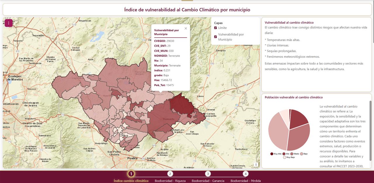
19°45′ N 19°05′ N 98°45′ W 97°35′ W Map of the climate change vulnerability index by municipality in Tlaxcala, Mexico
Climate change vulnerability index · Tlaxcala, MX 0 — 10 km
17years working with geospatial data
50+projects delivered
3countries: Colombia, Mexico, USA
44technical articles in Spanish
What I do

Services and products

Specialty

GIS development

I handle the work from preparing the data to publishing the web map.

  • WMS
    Web maps and geoportalsLeaflet · Mapbox · ArcGIS JS
  • SSP
    Climate atlases and story mapsRisk, vulnerability, climate scenarios
  • SQL
    Spatial data infrastructurePostGIS · GeoServer · OGC · tile caching
  • PWA
    Map apps for mobilePoints of interest, navigation, field data
See GIS services →
Products

Urbidata · ReportaloYa

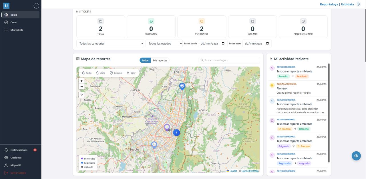
A georeferenced reporting platform with case tracking, dashboards and WhatsApp. It works for municipalities, residential complexes, universities, community boards and help desks.

See product →
With DigitalOnline

Digital solutions

Machine translation of documents, document and process management, BI dashboards, ERP and automation.

See solutions →
Projects

Recent projects

ColombiaLocal government · SaaS

Urbidata · ReportaloYa

Community reports on a map, with assigned owners, status tracking and dashboards.

PostGISLeafletAngular.NETWhatsApp
Oaxaca, MexicoEnvironment · Conservation

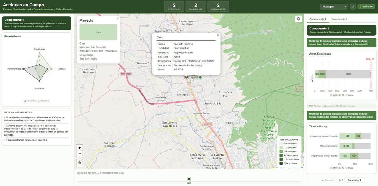
Acciones en Campo

Tracking of conservation actions in biocultural landscapes, fed from field forms and measured against project goals.

LeafletKoboToolboxGeoJSONQGIS
Key West, USATourism · Mobility

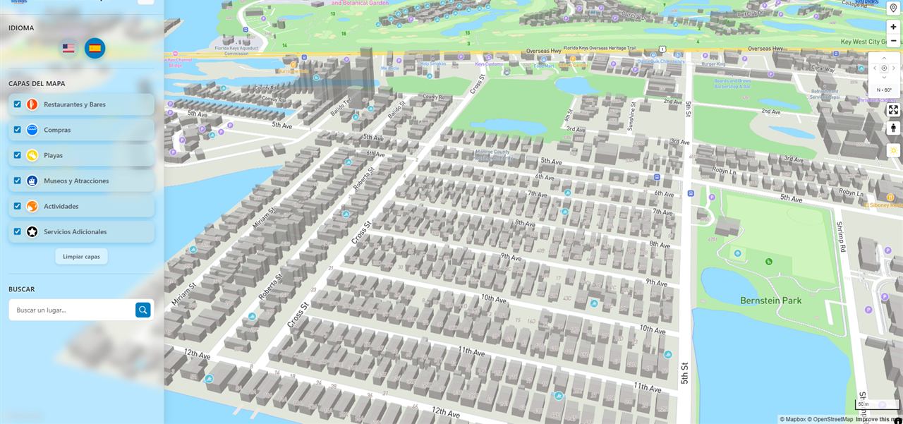
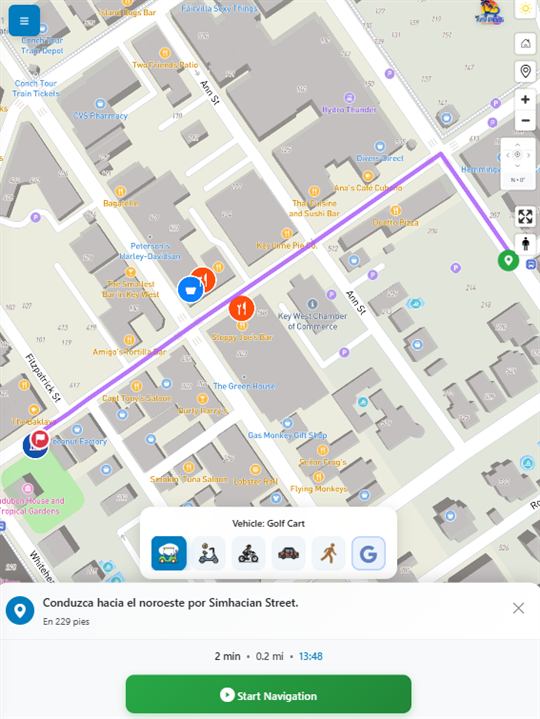
Mapa Turístico

Bilingual 3D Mapbox map app with points of interest and its own turn-by-turn navigation based on the rented vehicle.

Mapbox GLPWAGoogle SheetsJavaScript
Tlaxcala, MexicoGovernment · Climate

Atlas de Cambio Climático

Vulnerability, risk and biodiversity maps with SSP2-4.5 and SSP5-8.5 scenarios for 2041–2060, built as guided chapters.

LeafletGeoServerWMSJavaScript
Featured product

Urbidata: report management for any organization

A platform to receive, assign and resolve reports from a community. The person reporting marks the location on the map and attaches photos. The responsible team handles each case, and managers see response times and results on dashboards.

  • Reports located on the map
  • Photos, video and voice notes as evidence
  • Assignment, status and follow-up for each case
  • Dashboards by zone, category and response time
  • Email, push and WhatsApp alerts
  • Your own branding: logo, colors and subdomain

Categories, workflows, roles and branding are configured for each organization.

Municipalities and public agencies Residential complexes Universities and schools Community action boards (JAC) IT help desks Companies
ReportaloYa ticket board and report map
How I work

Project stages

  1. First review

    We look at your data, who will use the map and what decisions it should support.

  2. Proposal

    I send you the scope, the timeline and a fixed price.

  3. Development

    I share progress on a test link at regular intervals.

  4. Handover

    I publish the platform, hand over the documentation and train your team.

Mentoring packages

Mentoring for your GIS project

Packages of 60-minute sessions on Google Meet. You pay online and book each session in my open time slots.

5 sessions

To solve a specific problem in your project or learn how to use a tool.

xx USD · xx COP
  • 5 sessions of 60 min on Google Meet
  • Code and data review
  • Action plan after the first session
  • Valid for 90 days
Buy and book
Most popular
10 sessions

I support you from the design stage to the launch of your project.

xx USD · xx COP
  • 10 sessions of 60 min on Google Meet
  • Everything in the 5-session package
  • Architecture and deployment review
  • Valid for 180 days
Buy and book
Teams

Training for institutions and technical teams, planned around what they need.

Quoted per scope
  • Program built on your own data
  • Live sessions and recordings
  • Certificate of participation
Request a quote
Pay with Wompi (COP) or PayPal (USD) Your booking link arrives by email once payment is confirmed
Coming soon

DOL Translate: technical document translation that keeps the format

Upload Word, Excel, PDF or Visio. See the price instantly, pay online and receive the translation by email.

ES ⇄ EN ⇄ FR
Files up to 50 MB · PDFs with text See details
Tools

Open source and commercial software

QGISArcGISPostGISGeoServerMapProxyLeafletMapboxOpenLayersPythonKoboToolboxApache Superset.NETAngular AI agents
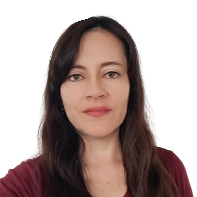
Johanna Valenzuela
About me

Johanna Valenzuela

I am a cadastral and geodetic engineer with a specialization in Geomatics and 17 years of work with geospatial data. Today I lead software projects with DigitalOnline that combine maps with workflows and artificial intelligence.

I also publish free courses, guides and dozens of articles in Spanish on Leaflet, PostGIS and GeoServer.

Contact

Do you have a GIS or data project?

Tell me what you need and I will send you a proposal with scope, timeline and price.

Emailinformacion@johagis.com
WhatsApp+57 350 434 6454
CommunityDiscord JohaGis
HoursMon–Fri, 9:00–17:00 (Bogotá time)
WhatsApp