Urbidata · ReportaloYa
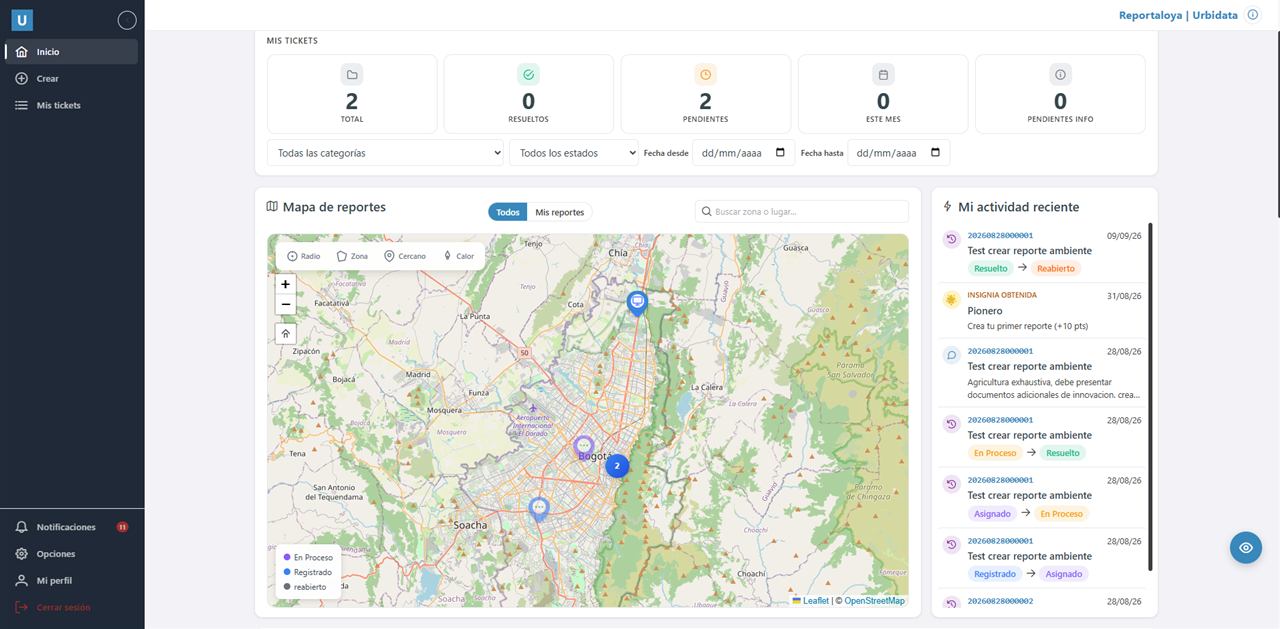
Community reports on a map, with assigned owners, status tracking and dashboards.
PostGISLeafletAngular.NETWhatsApp
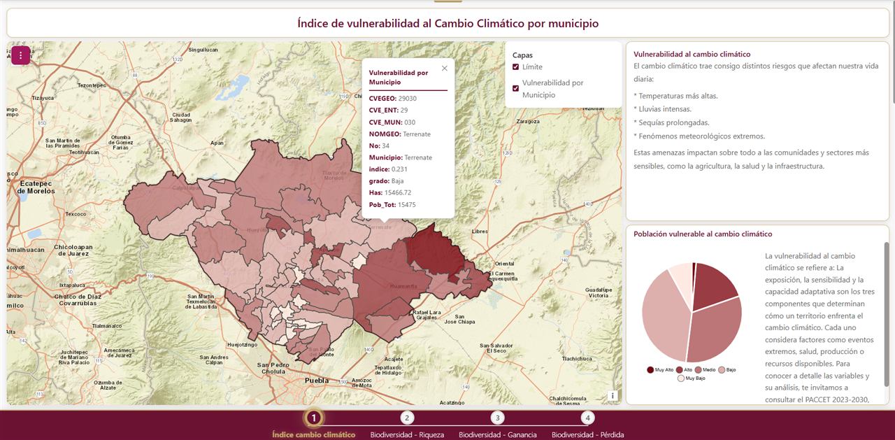
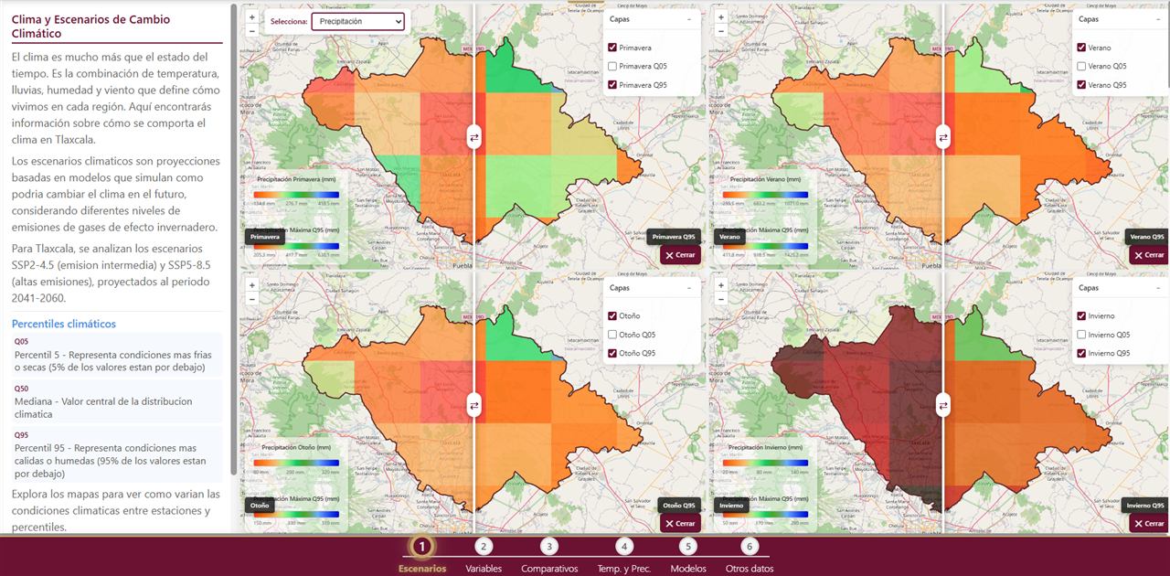
Vulnerability, risk and biodiversity maps with SSP2-4.5 and SSP5-8.5 scenarios for 2041–2060, built as guided chapters.
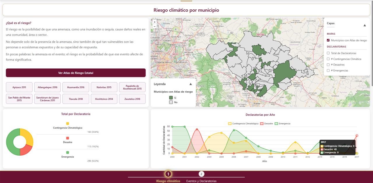
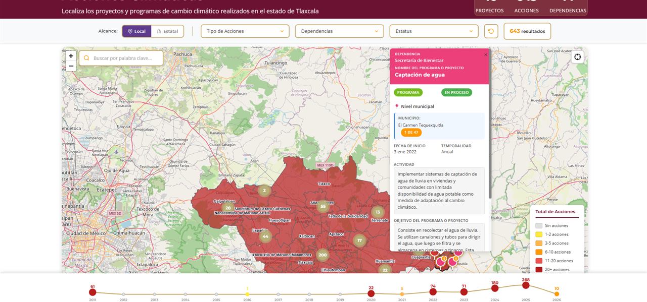
The government of Tlaxcala needed to communicate the results of its state climate change program to citizens and decision makers.
Turn technical indices and climate scenarios into maps anyone can explore and understand.
Chapter-based viewers: vulnerability index by municipality, climate risk and emergency declarations, biodiversity, comparers of temperature and precipitation scenarios by season, and a map of the state's climate actions with filters and a timeline.
Maps published on the state's official climate change portal.
Community reports on a map, with assigned owners, status tracking and dashboards.
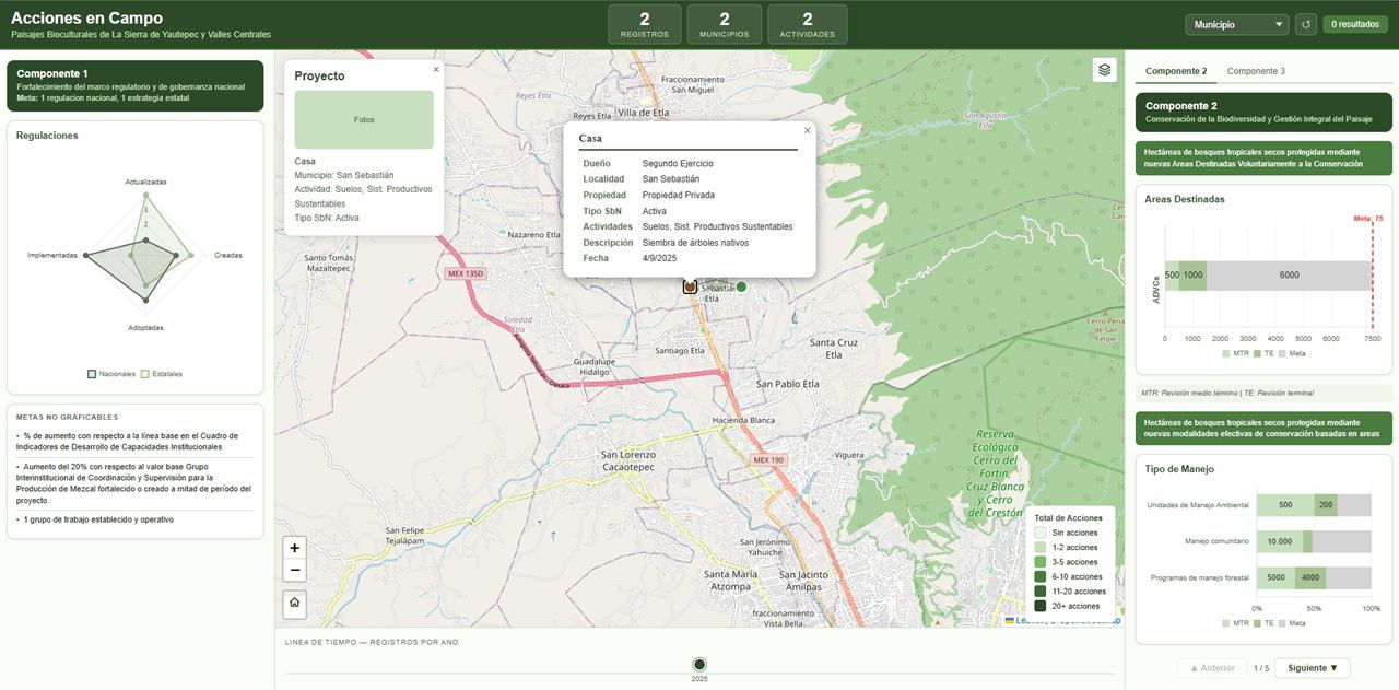
Tracking of conservation actions in biocultural landscapes, fed from field forms and measured against project goals.
Tell me what you need and I will send you a proposal with scope, timeline and price.