Urbidata · ReportaloYa
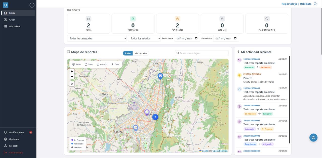
Community reports on a map, with assigned owners, status tracking and dashboards.
PostGISLeafletAngular.NETWhatsApp
A 16-hour online course so the GIS team at Brazil's Confederação Nacional do Transporte can build and maintain its own WebGIS applications with Mapbender.

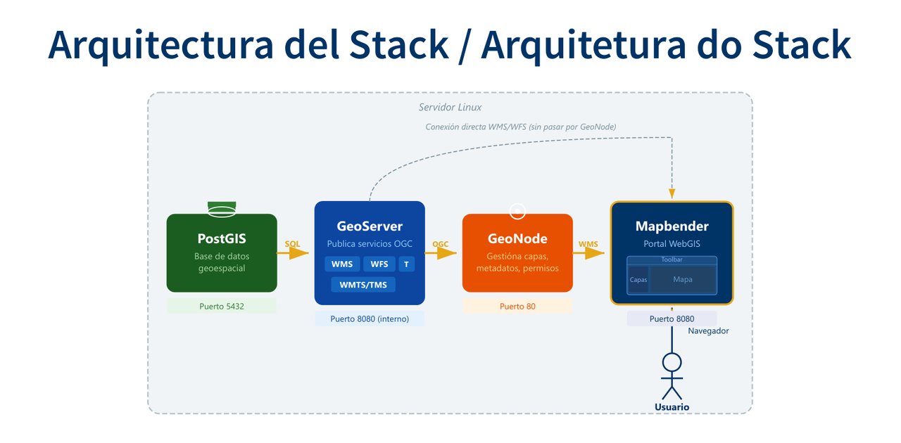
CNT already published its layers with PostGIS, GeoServer and GeoNode, and needed a WebGIS portal its own team could configure without relying on developers.
Cover the whole process in five days: install Mapbender on a Linux server, connect it to GeoServer services, build applications, manage users and permissions, and integrate it with dashboards.
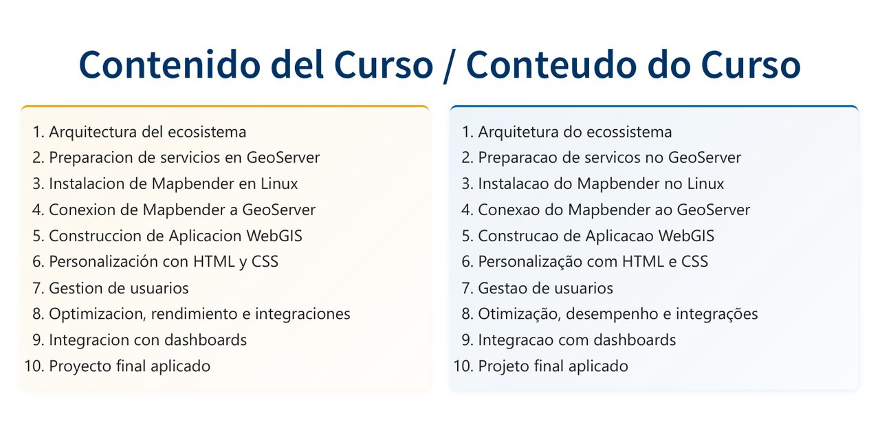
I designed and taught a hands-on course with 10 modules and materials in Spanish and Portuguese: slides, Docker installation manuals, a complete Mapbender guide, a question bank and a final project using their own services.
CNT's team kept the course materials, the installation and administration manuals, and a WebGIS application built in the final project.
Community reports on a map, with assigned owners, status tracking and dashboards.
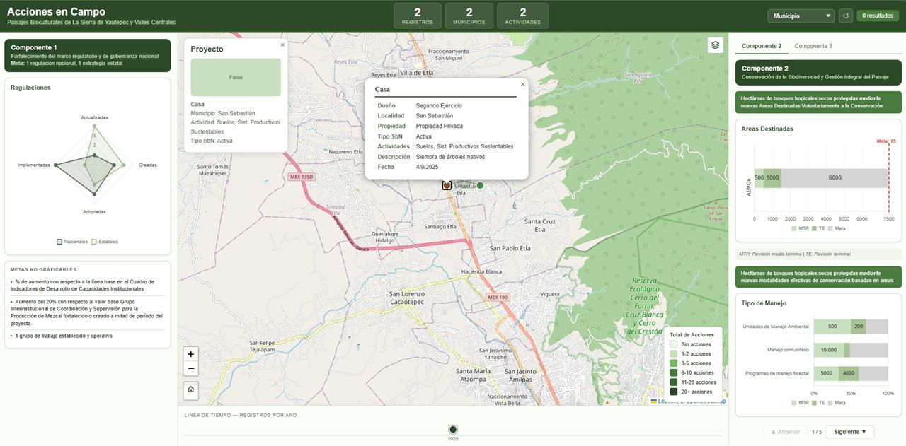
Tracking of conservation actions in biocultural landscapes, fed from field forms and measured against project goals.
Tell me what you need and I will send you a proposal with scope, timeline and price.